

Concern for coast mounts as two storms swirl in the Atlantic
Jose, Maria on track to hit U.S.
TRIPLE JEOPARDY. Two more hurricanes could strike the U.S. coast within the next week. This comes on the heels of Hurricanes Harvey and Irma, which have left behind billions of dollars worth of damage. Meanwhile, Hurricane Katia, which swirled in the Gulf at the same time as Irma and Jose, made landfall on September 15 just north of Tecolutla, Mexico as a Category 2 hurricane before dissipating.
Harvey and Irma are certainly not the end of the U.S.’s volatile hurricane season this year. Two other dangerous and strengthening storms that could potentially hit the states are currently swirling in the Atlantic Ocean.
Hurricane Jose, which was previously downgraded to a tropical storm, is back. It has grown into a Category 4 hurricane with 145 mph winds, following a similar path to Irma in the east Atlantic.
This is the first time on record three storms have been Category 4 or higher.
Jose missed the northeastern Lesser Antilles as well as the U.S. and British Virgin Islands as it churned northwestward on Sat., Sept. 16.
Hurricane warnings remain in effect for Sint Maarten, St. Martin, and St. Barthelemy, but it seems that they will not be receiving a direct hit.
“That’s relieving. It would have been so awful if the same islands that were hit by Irma were also hit by another powerful and damaging storm,” said Lavanya Konda, 12.
Experts think that Jose could impact the northeastern coast of the U.S. in the upcoming week. Tropical storm watches are possible for the area.
“[People in coastal areas from North Carolina to New England] should monitor the progress of this system,” said the National Hurricane Center (NHC) in its latest public advisory.
It is too early to predict the exact path Jose will take, but there is a great chance that at least part of the coast will be impacted.
“Although the center of Jose is forecast to pass well east of the North Carolina coast early next week, tropical-storm-force winds are expected to extend well west of the center and could approach the North Carolina Outer Banks on Monday.
“Farther north along the U.S. East Coast, the chance of some direct impacts from Jose is increasing, but it is too soon to determine their exact magnitude and location,” said Dennis Feltgen, a spokesman for NHC, in an email.
A new storm is also brewing. “Tropical Depression 15” is stirring in the Atlantic, and the system is forecast to strengthen and brush by islands that were recently wrecked by Hurricane Irma.
“There is already so much damage there. How much more can these areas take?” Konda said.
According to the NHC, it is expected to be upgraded to a tropical storm within hours and could be near hurricane status when it approaches the Leeward Islands on Monday night or Tuesday.
From there, it could follow Irma’s path of destruction over Puerto Rico and toward the Florida Keys as Hurricane Maria.
Currently, it is 695 miles east-southeast of the Lesser Antilles with sustained winds of 35 mph.
*UPDATE (September 18, 7:00 p.m.):
The tropical storm watch for Hurricane Jose has been upgraded to a warning for Rhode Island and eastern Massachusetts, which are expected to be the hardest hit.
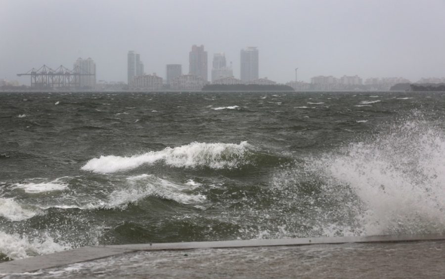
The worst conditions are likely to occur on Wednesday, where areas may get battered by heavy rain, damaging wind gusts, and coastal flooding. The storm’s peak winds are currently around 75 mph.
“Total [rain] accumulations of three to five inches are expected over eastern Long Island, southeast Connecticut, southern Rhode Island, and southeast Massachusetts, including Martha’s Vineyard and Nantucket,” the NHC said.
There is also a major threat for severe erosion along the beaches, which will be assaulted for an extended period of time because the storm is slow-moving.
Changes to Jose’s track may occur, but regardless of where it hits, dangerous surf and rip currents are expected along the east coast for the duration of the week.
Meanwhile, “Tropical Depression 15,” after being upgraded to a tropical storm, has once again been upgraded to a Category 4 hurricane. Hurricane Maria is rapidly intensifying, with current maximum sustained winds of 130 mph.
The highly dangerous hurricane is expected to cause widespread destruction along its path. Puerto Rico is on track to endure a direct hit from this storm.
“Maria is likely to affect Puerto Rico as an extremely dangerous major hurricane, and a hurricane warning is in effect for that island,” the NHC said.
This storm could be very close or even attain Category 5 intensity when it nears St. Croix and Puerto Rico. Only one Category 5 hurricane has hit Puerto Rico in recorded history; the last Category 4 storm struck the island in 1932.
Barbuda and Antigua, battered by Hurricane Irma, could be brushed by strong wind gusts and heavy rain from the storm though the worst part will pass south of the islands.
The islands hit by the center of Maria could face destructive winds of 120 to 150 mph in addition to six to 12 inches of rain, which could cause life-threatening flash floods.
Coastlines are expecting storm surges of at least six to nine feet above normal ground.
Beyond Friday, Hurricane Maria’s path is uncertain. However, there is a great chance that it could hit the U.S. east coast.
Sources:
- www.washingtonpost.com/news/capital-weather-gang/wp/2017/09/07/tropical-triple-threat-hurricanes-jose-and-katia-could-join-irma-in-striking-land-this-weekend/?utm_term=.da348155260b
- www.washingtonpost.com/world/the_americas/the-latest-norma-becomes-a-hurricane-over-pacific/2017/09/15/519433e0-9a91-11e7-af6a-6555caaeb8dc_story.html?utm_term=.b38ca240eea9
- www.washingtonpost.com/news/capital-weather-gang/wp/2017/09/18/intensifying-hurricane-maria-is-a-severe-threat-to-caribbean-and-puerto-rico-jose-to-scrape-northeast-coast/?utm_term=.f62f449c621c
- www.nytimes.com/2017/09/15/us/hurricane-jose-landfall.html
- time.com/4944806/where-is-hurricane-jose-right-now/
- www.nhc.noaa.gov/text/refresh/MIATCPAT2+shtml/152034.shtml
- www.usatoday.com/story/news/2017/09/16/hurricane-season-roars-tropical-storm-lee-forms-jose-threatens-east-coast/673482001/
- www.latimes.com/business/la-fi-harvey-economic-toll-20170901-story.html
- abcnews.go.com/US/hurricanes-harvey-irma-cost-us-economy-290-billion/story?id=49761970
Your donation will support the student journalists of Sycamore High School. Your contribution will allow us to purchase equipment and cover our annual website hosting costs.